Jet Propulsion Laboratory California Institute of Technology Follow this link to skip to the main content
Images
Press Release Images
Spirit
Opportunity
All Raw Images
Spirit
Opportunity
Panoramas
Spirit
Opportunity
3-D Images
Spirit
Opportunity
Spacecraft
Mars Artwork
Landing Sites
Press Release Images: Opportunity
17-Jan-2004
Opportunity Digs; Spirit Advances
Full Press Release
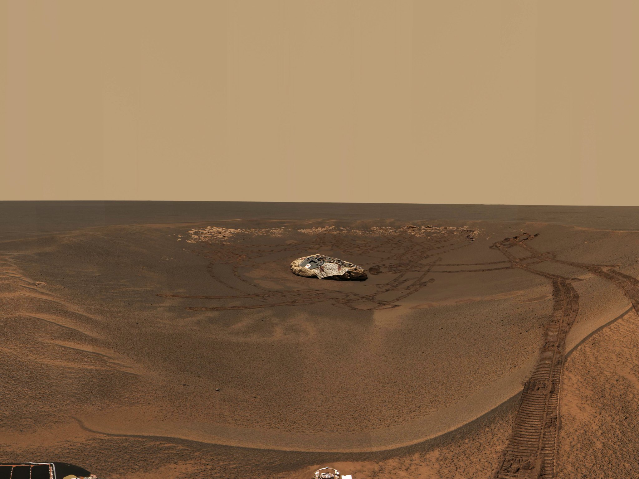
At Home in the Crater

The wheel tracks seen above and to the left of the lander trace the path the Mars Exploration Rover Opportunity has traveled since landing in a small crater at Meridiani Planum, Mars. After this picture was taken, the rover excavated a trench near the soil seen at the lower left corner of the image. This image mosaic was taken by the rover's navigation camera.
Image credit: NASA/JPL/Cornell
Browse Image | Medium Image (150 kB) | Large (2.6 MB)
Opportunity Trenches Martian Soil

The Mars Exploration Rover Opportunity dragged one of its wheels back and forth across the sandy soil at Meridiani Planum to create a hole (bottom left corner) approximately 50 centimeters (19.7 inches) long by 20 centimeters (7.9 inches) wide by 9 centimeters (3.5 inches) deep. The rover's instrument deployment device, or arm, will begin studying the fresh soil at the bottom of this trench later today for clues to its mineral composition and history. Scientists chose this particular site for digging because previous data taken by the rover's miniature thermal emission spectrometer indicated that it contains crystalline hematite, a mineral that sometimes forms in the presence of water. The brightness of the newly-exposed soil is thought to be either intrinsic to the soil itself, or a reflection of the Sun. Opportunity's lander is in the center of the image, and to the left is the rock outcrop lining the inner edge of the small crater that encircles the rover and lander. This mosaic image is made up of data from the rover's navigation and hazard-avoidance cameras.

Image credit: NASA/JPL
Browse Image | Medium Image (315 kB) | Large (2.3 MB)
The Road Less Traveled

This image is a screenshot from a computer-generated animation showing the path the Mars Exploration Rover Opportunity traveled between the 16th and 21st days, or sols, of its mission. On sol 16, the rover followed a "V-shaped" route, driving backwards 2.5 meters (8.2 feet), turning in place 49 degrees counterclockwise, driving forward by 1 meter (3.3 feet), then driving forward again another 0.6 meters (2 feet). On sol 17, the rover traversed a "U-shaped" path, driving backwards 1.3 meters (4.3 feet), turning in place 90 degrees counterclockwise, driving forward 2.9 meters (9.5 feet), turning in place 90 degrees clockwise, driving forward 0.6 meters (2 feet), then finally driving forward again 0.5 meters (1.6 feet). On sol 19, the rover took another "V-shaped" journey, driving south backwards for approximately 1.9 meters (6.2 feet), turning in place to face the west-northwest rock target Zugspitze, then driving forward 2.5 meters (8.2 feet). On sol 21, the rover backed up 1.4 meters (4.6 meters), turned to the southwest, then via a series of arc turns, arrived at its trench location. Once there, the rover rotated 180 degrees to face 10 degrees to the west of north, then drove a short 0.5-meter-arc (1.6-foot-arc) forward. The drive ended with the rover facing approximately north, ready to dig a hole in the martian surface. Data from the rover's onboard sensors were used to make this animation.

Image credit: NASA/JPL
Browse Image (21 kB) | Large (183 kB)
Opportunity Digs
Opportunity Digs

This image is a screenshot from a computer-generated animation showing the Mars Exploration Rover Opportunity trenching a hole in the sandy soil at Meridiani Planum, Mars. Data taken during trenching by the rover's onboard sensors were used to create the movie.
Image credit: NASA/JPL
Browse Image (24 kB) | Large (158 kB)
Browse Image (56 kB) | Large (104 kB)
What Lies Beneath
What Lies Beneath

The Mars Exploration Rover Opportunity dragged one of its wheels back and forth across the sandy soil at Meridiani Planum to create a hole (center) measuring approximately 50 centimeters (19.7 inches) long by 20 centimeters (7.9 inches) wide by 9 centimeters (3.5 inches) deep. The rover's instrument deployment device, or arm, will begin studying the fresh soil at the bottom of the trench later today for clues to its mineral composition and history. Scientists chose this particular site for trenching because previous data taken by the rover's miniature thermal emission spectrometer indicated that it contains crystalline hematite, a mineral that sometimes forms in the presence of water. The brightness of the newly-exposed soil is thought to be either intrinsic to the soil itself, or a reflection of the Sun. This image was taken by the rover's hazard-avoidance camera.

Image credit: NASA/JPL
Browse Image (26 kB) | Large (134 kB)
Peeling Back the Layers of Mars

This is a 3-D model of the trench excavated by the Mars Exploration Rover Opportunity on the 23rd day, or sol, of its mission. An oblique view of the trench from a bit above and to the right of the rover's right wheel is shown. The model was generated from images acquired by the rover's front hazard-avoidance cameras.

Image credit: NASA/JPL/Ames
Browse Image | Medium Image (109 kB) | Large (776 kB)
Fresh Soil for Inspection

The Mars Exploration Rover Opportunity dragged one of its wheels back and forth across the sandy soil at Meridiani Planum to create a hole (bottom of image) measuring approximately 50 centimeters (19.7 inches) long by 20 centimeters (7.9 inches) wide by 9 centimeters (3.5 inches) deep. The rover's instrument deployment device, or arm, will begin studying the fresh soil at the bottom of this trench later today for clues to its mineral composition and history. Scientists chose this particular site for digging because previous data taken by the rover's miniature thermal emission spectrometer indicated that it contains crystalline hematite, a mineral that sometimes forms in the presence of water. The brightness of the newly-exposed soil is thought to be either intrinsic to the soil itself, or a reflection of the Sun. The rock outcrop lining the inner edge of the small crater encircling the rover and lander can be seen on the horizon. This fish-eye image was taken by the rover's hazard-avoidance camera.

Image credit: NASA/JPL
Browse Image (34 kB) | Large (317 kB)
Opportunity Within Crater

This composite image shows a bird's-eye view of the crater occupied by the Mars Exploration Rover Opportunity at Meridiani Planum, Mars. A portion of the lander can be seen to the bottom left of the image's circular center. Bounce marks can be seen below and to the top left of the center. The rock outcrop containing many of the rover's rock targets runs from the top right of the image to the left of the image. The rover, which cannot be seen in the image, is located in the southwest quadrant, just left of the lander. Data depicting the inside of the crater wall is from the rover�s panoramic camera. Data depicting the outside of the crater wall is from the camera on the orbiting Mars Global Surveyor. The top of the image faces north, and the image area measures approximately 22 meters (72 feet) wide.
Image credit: JPL/NASA/Cornell/MSSS/Ohio State University
Browse Image | Medium Image (77 kB) | Large (993 kB)
Opportunity Future Traverse Map

This composite image maps a future travel itinerary for the Mars Exploration Rover Opportunity at Meridiani Planum, Mars. The rover is currently located at the trench site toward the bottom left of the image. It has already been to the location named "Stone Mountain." Controllers plan to investigate the other labeled areas on the rock outcrop. Data depicting the inside of the crater wall is from the rover�s panoramic camera. Data depicting the outside of the crater wall is from the camera on the orbiting Mars Global Surveyor. The top of the image faces north, and the image area measures approximately 22 meters (72 feet) wide.

Image credit: JPL/NASA/Cornell/MSSS/Ohio State University
Browse Image | Medium Image (82 kB) | Large (1 MB)
Opportunity Traverse Map

This composite image maps the areas traveled by the Mars Exploration Rover Opportunity at Meridiani Planum, Mars. Dotted lines represent areas the rover has already traveled. Solid lines represent areas still on the rover's travel agenda. Data depicting the inside of the crater wall is from the rover�s panoramic camera. Data depicting the outside of the crater wall is from the camera on the orbiting Mars Global Surveyor. The top of the image faces north, and the image area measures approximately 22 meters (72 feet) wide.

Image credit: JPL/NASA/Cornell/MSSS/Ohio State University
Browse Image | Medium Image (91 kB) | Large (1.1 MB)
Track-and-Trench 2
Track-and-Trench

This image shows the tracks and trench marks made by the Mars Exploration Rover Opportunity at Meridiani Planum, Mars. The rover can be seen to the lower left of the lander. The trench is visible to the upper left of the rover, which has traveled a total of 35.3 meters (116 feet) since leaving the lander on sol 7 (January 31, 2004). On sol 23 (February 16, 2004), the rover used one of its wheels to dig a trench measuring approximately 10 centimeters (4 inches) deep, 50 centimeters (20 inches) long, and 20 centimeters (8 inches) wide. This vertically projected image was created using a combination of images from the rover�s navigation camera and hazard-avoidance cameras.

Image credit: NASA/JPL/Cornell
Browse Image | Medium Image (74 kB) | Large (841 kB)
Track-and-Trench 2
Track-and-Trench 2

This image shows the tracks and trench marks made by the Mars Exploration Rover Opportunity at Meridiani Planum, Mars. The rover can be seen to the lower left of the lander. The trench is visible to the upper left of the rover, which has traveled a total of 35.3 meters (116 feet) since leaving the lander on sol 7 (January 31, 2004). On sol 23 (February 16, 2004), the rover used one of its wheels to dig a trench measuring approximately 10 centimeters (4 inches) deep, 50 centimeters (20 inches) long, and 20 centimeters (8 inches) wide. This polar-projected image showing the horizon was created using a combination of images from the rover�s navigation camera and hazard-avoidance cameras.

Image credit: NASA/JPL/Cornell
Browse Image | Medium Image (333 kB) | Large (4.1 MB)

JPL Image Use Policy

USA.gov
PRIVACY   I   IMAGE POLICY   I   FAQ   I   SITEMAP   I   CREDITS