Jet Propulsion Laboratory California Institute of Technology Follow this link to skip to the main content
Images
Press Release Images
Spirit
Opportunity
All Raw Images
Spirit
Opportunity
Panoramas
Spirit
Opportunity
3-D Images
Spirit
Opportunity
Spacecraft
Mars Artwork
Landing Sites
Press Release Images: Opportunity
05-Mar-2004
 
 
The Outcrop in a Nutshell

This image mosaic taken by the panoramic camera onboard the Mars Exploration Rover Opportunity highlights various rock targets within the outcrop lining the inner edge of the small crater where the rover landed. Opportunity recently finished examining the rock dubbed "Last Chance," then rolled over to "Wave Ripple," a section of rock in the region nicknamed "The Dells." Tomorrow, the rover will take a series of "touch-and-go" microscopic images at "Wave Ripple," before heading to another rock region with targets named "Slick Rock" and "Berry Bowl."

Image credit: NASA/JPL/Cornell
Browse Image | Medium Image (350 kB) | Large (2.2 MB)
Rare Glance at 'Last Chance'
Rare Glance at "Last Chance"

This three dimensional model shows a region of the outcrop dubbed "Last Chance" near the Mars Exploration Rover Opportunity's landing site. The model was created with images taken by the rover's panoramic camera. The layered rocks were recently the subject of an extensive series of microscopic images.

Image credit: NASA/JPL/Cornell/Ames
Browse Image | Medium Image (60 kB) | Large (512 kB)
'Blueberry' Exposed
"Blueberry" Exposed

This three-dimensional model shows a postage-stamp-sized patch of the rock target in the outcrop near the Mars Exploration Rover Opportunity's landing site. A sliced sphere-like particle, or "blueberry," can be seen to the far right of the model. The model was created from images taken by the rover's microscopic imager, after the surface of the rock was scraped away with the rock abrasion tool.

Image credit: NASA/JPL/Cornell/USGS/Ames
Browse Image (27 kB) | Large (306 kB)
Spotlight on 'El Capitan'
Spotlight on "El Capitan"

This image taken by the Mars Exploration Rover Opportunity's panoramic camera shows the outcrop that sits just inside the small crater where the rover landed. Highlighted in black and white is the region dubbed "El Capitan," where scientists gained their first clues to the outcrop's watery past. The color portion of the image is low-resolution, and the black and white portion is high-resolution.

Image credit: NASA/JPL/Cornell
Browse Image | Medium Image (50 kB) | Large (618 kB)
Windows to Meridiani's Water-Soaked Past

This image taken by the Mars Exploration Rover Opportunity shows the two holes that allowed scientists to peer into Meridiani Planum's wet past. The rover drilled the holes into rocks in the region dubbed "El Capitan" with its rock abrasion tool. By analyzing the freshly exposed rock with the rover's suite of scientific instruments, scientists gathered evidence that this part of Mars may have once been drenched in water. The lower hole, located on a target called "McKittrick," was made on the 30th martian day, or sol, of Opportunity's journey. The upper hole, located on a target called "Guadalupe" was made on the 34th sol of the rover's mission. This image was taken on the 35th martian day, or sol, by the rover's hazard-avoidance camera. The rock abrasion tool and scientific instruments are located on the rover's robotic arm.

Image credit: NASA/JPL
Browse Image (27 kB) | Large (192 kB)
You Dirty Rat!
You Dirty Rat!

This image taken by the Mars Exploration Rover Opportunity's panoramic camera shows the rover's rock abrasion tool before and after it ground into a rock at the region dubbed "El Capitan." Color and spectral properties of the dust show that it many contain some fine-grained hematite. The image on the left was taken on the 29th martian day, or sol, of the rover's mission, and the image on the right on the 31st sol. Both images were acquired using the camera's red, green and blue filters.

Image credit: NASA/JPL/Cornell
Browse Image | Medium Image (154 kB) | Large (1.2 MB)
'Hole1' Lotta Grindin' Going On
"Hole" Lotta Grindin' Going On

The red marks in this image, taken by the Mars Exploration Rover Opportunity's panoramic camera, indicate holes made by the rover's rock abrasion tool, located on its instrument deployment device, or "arm." The lower hole, located on a target called "McKittrick," was made on the 30th martian day, or sol, of Opportunity's journey. The upper hole, located on a target called "Guadalupe" was made on sol 34 of the rover's mission. The mosaic image was taken using a blue filter at the "El Capitan" region of the Meridiani Planum, Mars, rock outcrop. The image, shown in a vertical-perspective map projection, consists of images acquired on sols 27, 29 and 30 of the rover's mission.

Image credit: NASA/JPL/Cornell
Browse Image (71 kB) | Large (369 kB)
Seeing Red at Guadalupe

This image from the Mars Exploration Rover Opportunity's panoramic camera shows the results of the second drilling by the rock abrasion tool, located on the rover's instrument deployment device, or "arm." The drilling took place on a target called "Guadalupe" within the "El Capitan" region of the Meridiani Planum, Mars, rock outcrop.

As with the first rock abrasion tool target called "McKittrick," the grinding process at "Guadalupe" has generated a significant amount of fine-grained, reddish dust. Color and spectral properties of the dust show that it may contain some fine-grained crystalline red hematite. This image is an enhanced color composite generated from three different panoramic camera filters.

Image credit: NASA/JPL/Cornell
Browse Image (56 kB) | Large (725 kB)
Messy Grind
Messy Grind

This image shows the results of the Mars Exploration Rover Opportunity's grinding of its first target with the rock abrasion tool, located on its instrument deployment device, or "arm." The target, called "McKittrick," is located on the "El Capitan" region of the rock outcrop at Meridiani Planum, Mars.

The grinding process at "McKittrick" has generated a significant amount of fine-grained, reddish dust. Color and spectral properties of the dust show that it may contain some fine-grained crystalline red hematite. This image is an enhanced color composite generated from three different panoramic camera filters.

Image credit: NASA/JPL/Cornell
Browse Image | Medium Image (114 kB) | Large (723 kB)
Browse Image | Medium Image (195 kB) | Large (543 kB)
 
Opportunity's Heatshield on the Horizon

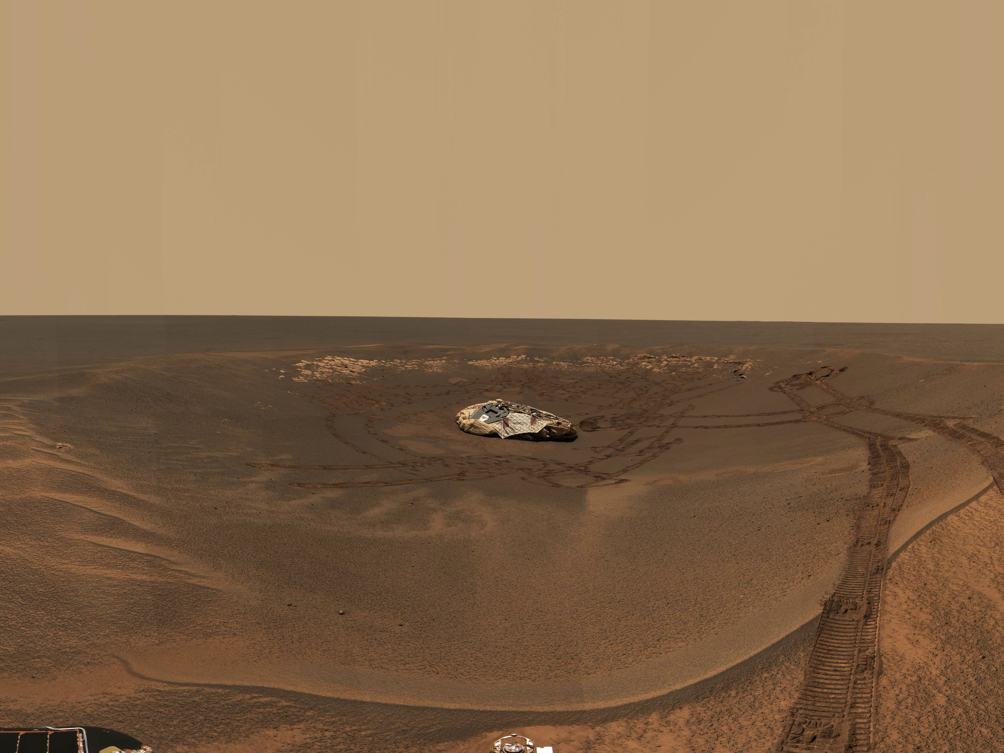
This image mosaic from the panoramic camera on the Mars Exploration Rover Opportunity shows the distant horizon from Opportunity's position inside a small crater at Meridiani Planum, Mars. To the left is a large crater about 700 meters (2,296 feet) away from the landing site and approximately 200 meters (656 feet) in diameter. In the center, Opportunity's heatshield and its impact mark can be seen at a distance of approximately 875 meters (one-half mile) from the landing site. To the right, a string of bounce marks left by the rover's airbags is visible. Near the mark just outside the landing site crater's rim is the largest rock in the area. This rock is about 40 centimeters (16 inches) across and 50 meters (164 feet) from the rover's position. The image is an enhanced color composite acquired on the 35th and 36th martian days, or sols, of Opportunity's journey, using three different wavelength filters.

Image credit: NASA/JPL/Cornell
Browse Image | Medium Image (226 kB) | Large (2.4 MB)
Rover Magnets All Around

This illustration shows the locations of the various magnets on the Mars Exploration Rover, which are: its front side, or chest; its back, near the color calibration target; and on its rock abrasion tool. Scientists will use these tools to collect dust for detailed studies. The origins of martian dust are a mystery, although it is believed to come from at least one of three sources: volcanic ash, pulverized rocks or mineral precipitates from liqiud water. By studying the dust with the rover's two spectrometers, scientists hope to find an answer.

Image credit: NASA/JPL
Browse Image | Medium Image (418 kB) | Large (3.35 kB)
Martian Dust Mostly Magnetic

This image composite highlights the Mars Exploration Rover Opportunity's "sweep" magnet, which scientists use to study the origins of dust in the atmosphere. The panoramic image below indicates the location of the magnet on the side of the rover's calibration target, or "martian sundial." The images above, also taken by the panoramic camera, show a close-up of the magnet and the dark ring that collects magnetic airborne particles. The bright hole in the center of the magnet repels magnetic particles, forcing them to land only on the outer ring. Non-magnetic particles are expected to settle on all parts of the magnet, including the center. Because this center hole remains clean, scientists have concluded that nearly all of the dust particles in Mars' atmosphere are magnetic.

Image credit: NASA/JPL/Cornell
Browse Image | Medium Image (73 kB) | Large (1.3 MB)
Rules of Attraction
Rules of Attraction

This image composite shows two of the Mars Exploration Rover Opportunity's magnets, the "capture" magnet (upper portion of left panel) and the "filter" magnet (lower portion of left panel). Scientists use these tools to study the origins of martian dust in the atmosphere. The left panel was taken by the rover's panoramic camera. The four panels to the right, taken by the microscopic imager, show close-up views of the two magnets. The bull's-eye appearance of the capture magnet is a result of alternating magnetic fields, which are used to increase overall magnetic force. The filter magnet lacks these alternating fields and consequently produces a weaker magnetic force. This weaker force selectively attracts only strong magnetic particles. Scientists were surprised by the large dark particles on the magnets because airborne particles are smaller in size. They theorize that these spots might be aggregates of small particles that clump together in a magnetic field.

Image credit: NASA/JPL/Cornell/USGS
Browse Image | Medium Image (114 kB) | Large (3.5 MB)

JPL Image Use Policy

USA.gov
PRIVACY   I   IMAGE POLICY   I   FAQ   I   SITEMAP   I   CREDITS